Enough of this hitch-hiking talk. Let’s get back to hiking. I started hiking on the 20th, 10 days ago. Hiking takes most of my time during the day. I don’t have mobile Internet, so I’m rarely online. This small keyboard is killing me. The posts will have a ~10-day delay because of that. Hiking has already been a lot of fun, and my legs aren’t as sore as they used to be. See you again in a few days =).
Monthly Archives: June 2014
The route pt. 3
I have decided to follow the E5 at first. But what exactly is the E5?
I haven’t met anyone who was even heard of the E-paths here in France yet.
The ERA has a very crude map, Traildino has a not-so-crude map and some textual descriptions of the route. It mentions the GRs, to be taken in France, but that’s it. I haven’t found any comprehensive guide about the E5.
So, what am I going to do? I compare the maps and the description in Traildino with the maps on GR-Infos and build the route based on that.
To download the GPS track from GR-Infos I use “view-source:” in Google Chrome, and look for the Google Maps link. Then I remove the “embed” part of the link and get a description about the individual route in Google Maps. I can then download the KML file and use OSMNavigator or Google Earth on my smartphone to guide myself.
Now I hardly get lost and I’m building my route as I go =).
Gear: The Smartphone
Maps, GPS logging, camera and communication, all in one device.
Paper maps are big and an unnecessary weight. They might tear when wet (if not waterproof) and are expensive. I also get lost easily with normal paper maps.
GPS logging is useful to keep track of the trails and to share them with other people (in this blog for example).
A camera is good for taking pictures of Laetitia and food.
Communication is essential on emergency situations and quite nice to keep in touch with some parts of the real world.
Instead of using many different gadgets, for each of these purposes, I decided to use just one smartphone for all those purposes.
But I had never had a smartphone before. My trusty old Nokia 1100 died recently after 9 years of constant use. So I had to go and choose a smartphone.
I wanted an Android phone, because it’s open-source and there are a zillion apps. The most important issue for me was the battery: it had to last very long. I also needed a good camera. Based on that, I started my search, reading reviews, comparisons, and looking on online shops. I came to the conclusion that there were way too many models, the prices ranged from “kind of expensive” to “really expensive” and after a few days I still had no idea which one to buy. In the meantime, I thought a larger screen would help, since I can’t type properly on such a small keyboard.
My head was overwhelmed with so many reviews and so much information, so I just picked one already: the Samsung Note 3 Neo.
It’s not a workhorse smartphone, so the battery doesn’t drain too fast. It might be a little bit slower than other models, but that didn’t bother me.
It’s somewhat big, which became a problem. Since it’s an odd size (unlike the S4 and such), I couldn’t find a cover for it. No protection, which is important for hiking. It’s also hard to hold if to take a picture with just one hand.
I’m still lost in this Android world. I keep hitting the back key inadvertently.
I’m using the GPSLogger App or logging. It’s lightweight and exactly what I was looking for.
I use Google Maps and OSMNavigator all the time. I really mean it: all the time. With the maps and trails cached for offline viewing, I use the compass and the GPS and I hardly ever get lost now!
The camera is not that good. Oh, well. Too bad.
When I stop in villages with some WiFi, I check my e-mail, use WhatsApp and try to post something. It’s hard to write letter by letter on such a small keyboard though. Laetitia helps me type the posts, since she has small paws.
The feature I use the last is the phone itself. I never liked phones anyways…
GR-Infos
GR stands for “Grande Randonée”, French for “long distance footpath”. This apparently simple web site has an extensive list of the GRS in France.
This website is the gold mine I was looking for. It has the GPS tracks for all the GRs, It’s quite impressive.
There are topo-guides and IGN cartes here in France, but I don’t like paper. This website has it all virtually.
Traildino
The ERA website suggests we go to their partner website, Traildino, to get more information on the european routes. Indeed, in the ERA website, there’s close to no information on the routes themselves, except for a really crude map.
Traildino has a lot of information about hiking trails all around the world. It has comments, ratings, some maps, references and links to experiences on the trails.
I am using Traildino to set up my route on a big scale. I see which “Grande Randonée” the E5 corresponds to and look at those GRs individually.
The hitch-hiking experience pt. 5
My hhiking experience ends in Pointe du Raz, on June 20, 2014, where my hiking experience begins.
I walked to a good spot at the end of the Pont-Croix, wrote “Pointe du Raz” in a pizza box, walked accross the street to take a picture and that was it, a car had already pulled up. I got my last ride in an instant.
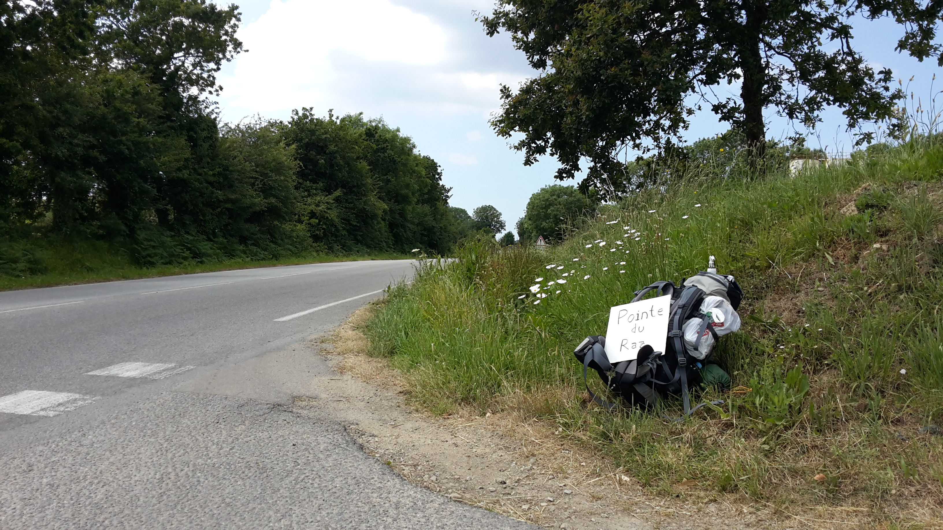
The driver was going fishing at Pointe du Raz and dropped me off close to the start of the trail.
What have I learned from this?
Brittany is really nice, the weather is good, the people are nice, the landscape is nice and everything seems so calm. They are “fier d’être Breton”. There are no tolls on the routes and they have kept away the nuclear power plants.
Celebration #1
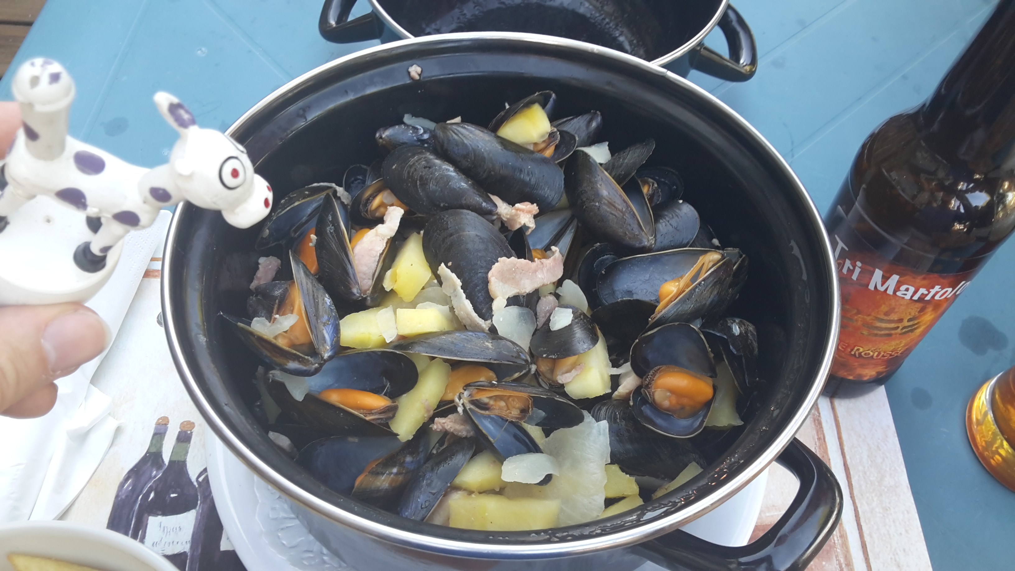
When I got to Pont-Croix, it was a happy and sunny day. It was a good opportunity to celebrate, after 1700 km hitch-hiking. I was hungry and wanted something local, so “moule à la bretonne” seemed like a good choice.
My stomach was behaving well and it would be many hours until I had to take my medications, so I decided it would be ok to try a local beer. One bottle of Tri Martolod wouldn’t hurt.
Indeed, the food was great and the beer was awesome: the first in many months.
The hitch-hiking experience pt. 4
On June 18, 2014, after spending the night in Nantes I left early towards Finistere. This is the GPSLogger track I followed:
Hitchwiki pointed to a nice hhiking spot close to a commercial center.
The spot really was good.

I got a ride very quickly. One thing I didn’t notice, though was that the station I would be dropped off was just outside the road.
I asked a few cars, as after a short while a lady from the station told me it was a bad idea. The traffic was mostly local, I should go outside the station. She gave me a cardboard, told me to write “Vannes s.v.p”, with a smiley face, and said “good luck”.
The traffic was still mostly local. I was in a bad spot. After some time, an old couple stopped and told me “go to the road directly”, I said that wasn’t allowed, and they replied “you certainly won’t get a ride here”…
So the drove me to the entrance of the road and said “good luck”. I wasn’t nervous, but I knew I had to get out of there quick.
Luckily, in some 15 minutes I got a ride. I asked to be dropped off in a station in the road this time.
Once I got to the station, I started writing “Quimper s.v.p” (with a smiley face) on the other side of the cardboard and a nice couple offered me a ride. I hadn’t even finished writing on the cardboard.
They let me in a “covoiturage” spot. It’s just a parking spot near the road. It took the same time to get a ride. A guy offered to drop me off in a good roundabout. I said I had run out of cardboard, and the just happened to have a box in the backseat. I cut myself a piece off the board and he dropped me off.
I hadn’t finished writing on the board for the second time and got offered a ride, but it was too close, so I decided to wait longer. Once I finished writing Audierne (actually I wanted to go to Pont-Croix, but they’re only some 10 km apart) I got offered another ride. It was closer but not quite there. In a minute or two I got offered another ride, directly to Pont-Croix, with a nice family with two little boys.
What have I learned from this? Once in the road, don’t leave it! Also that people in Brittany are really really nice, and that you might not have time to write your destination in the board.
The hitch-hiking experience pt. 3
On June 17, 2014, after a few days in Paris I headed towards Rennes. This is the GPSLogger track I followed:
Hitchwiki suggested that hhiking out of Paris toward the direction I wanted might take long.
I went to the specified location and it was filled with parked cars. After half an hour of no success, I decided to get closer to the road.
I the end I walked 4Km stopping at many points for varied periods of time. 3 hours had already gone by. I walked back to the first point and waited another half hour. Finally a cart stopped. A nice Colombian woman offered me a ride to the “Total” station on her way. Not too far, but at least it was on the correct path, and on the road.
By the time we got there, it was already so late that I warned my CouchSurfing host that I might not make it during the day.
After some 20 minutes in the station, two girls came up to me and offered me a ride. But they were going to Nantes, not Rennes. I said I didn’t have a place to stay in Nantes. Marie, one of the girls said she was a CSer as well and that she could probably host me.
I got in the car. After a few phone calls it was settled: she could host me. We got there at around midnight.
What have I learned from this? Paris can be a really hard place to hitch out from. And that there are people nice enough to host a stranded hitch-hiker in the last minute.
The hitch-hiking experience pt. 2
On June 15, 2014, after a few days in Brussels, I headed towards Paris.
I followed the directions in Hitchwiki and went to Drogenbos. But I walked all the way to the station instead of asking for a ride to the station.
This time I was more prepared, with a list of the good stations I could stop at on the way to Paris. After a while I got a ride on a van. It was two French guys from a rock band that had played in a festival near Brussels. They took me to a good station, Saint-Ghislain, close to Mons.

After some 15 minutes I got a ride directly to Paris with 2 women. That was much easier that the previous hhiking day.
In Paris they left me close to a Metro Station, it was easy to find myself. I still had no internet connection though.